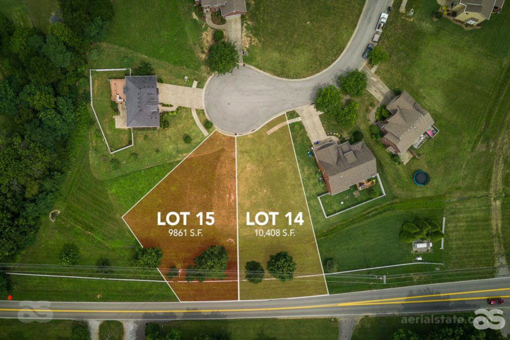
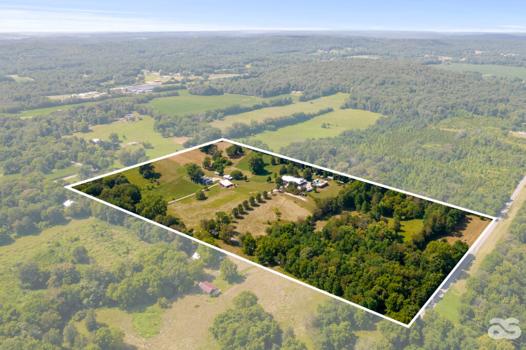
Property Outlines : Showing All Four Corners of the Property Line
Property lines, or boundary lines, define the points where properties begin and end. As a homeowner, knowing where your property begins and ends can prevent potential un-pleasantries or legal disputes with your neighbors. It can also ensure that you’re respecting your neighbor’s privacy and space. When it comes to selling a home, having a good understanding of the home’s property line is very important on the side of the realtor, the home buyer, and also the real estate photographer. As the photographer, it is our job to provide a solid visual for the realtor so that a potential buyer can see exactly what they are getting. Ariel photos of the property and home itself can give that necessary lay of the land. However, if the boundary line is not blatantly obvious, adding an approximate property outline to the image itself can be a game changer. It allows the buyer to truly have a bird’s eye view of every inch they are purchasing.
How To Find Property Lines
While locating property lines might seem like a big extra step, there are many easy ways to find or evaluate one. If you are a photographer working with a realtor, they should be able to provide you with a map of the property line, or ‘Plat’. With that being said, here are some ways for anyone to locate a property line.
– Read The Property Line Map, Or ‘Plat’
A property line map, or a “plat,” is a drawing that maps out a property’s boundary lines, and includes details like elevations, bodies of water and structures.
– Look For Property Line Markers
Some newer properties might include property line markers, such as stakes, from when the properties were first divided. If you are working with a more recent property, you can likely still find these markers if you walk the property lines and look closely for stakes that are either sticking up or are flush with the ground. It is also possible to note stakes while you have a drone in the air.
– Find The Property Line Online
The county may have online maps for all of the real estate in the area, accessible through the official county or assessor’s website. Property lines can also be found through any online search engine on Geographical Information System (GIS) maps. Another way to view property lines online is on interactive online maps.
– ZILLOW
Another great resource for lot lines is Zillow. If you go to Zillow and search for an address you will have the property details show up. Click on the map and select lot lines in the upper left corner.
Now What?
Once the property line is obtained, this is where the photographer can work their magic. When taking the initial aerial shot of the property from above, try to get as high up as possible in order to frame the whole lot. Make sure to capture any landmarks such as roads and buildings. Visual landmarks will make it easier for you to overlay the lot lines later. Adding the outline to the photo itself should not be too daunting of a task. Check out this quick tutorial on adding an outline to an image.
At the end of the day, the outline you add to the image is only approximate. The realtor will know this, and most people looking at the property images will understand this too, but it is always good to keep that disclaimer in the back of your mind. Aerial State Media is there to provide you with everything you need to present a property listing in a way that speaks clearly to potential buyers. Check out more examples here on our website. Property outlines are one simple way of taking real estate photography, and a listing itself, to the next level.


