Where You Are, And Are Not, Allowed to Fly Drones in the US
In the USA, there are three major rules that govern where you can and can’t fly your photography drone. To put it simply, you’re not allowed to take to the skies over US National Parks, US Military Bases, or within a five mile radius of a decent sized airport. While the FAA deliberates on rules and regulations, states, cities and other national organizations have implemented their own no-fly zones. You have to also take into account local ordinances that may ban them from certain places (which is definitely a thing that’s starting to happen).
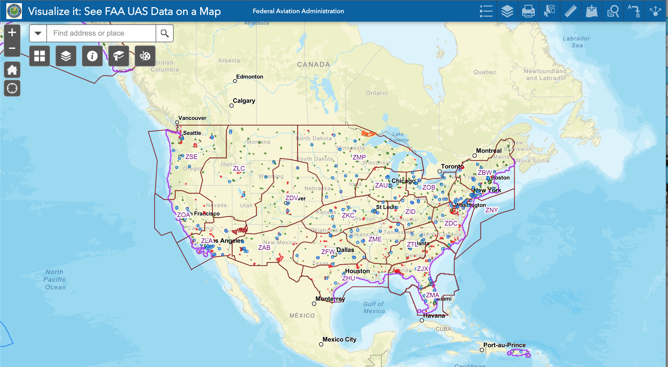
UAS Facility Maps show the maximum altitudes around airports where the FAA may authorize part 107 UAS operations without additional safety analysis. By visiting the FAA website or directly to the map, you will be able to determine if requests for part 107 airspace authorizations and waivers in controlled airspace are needed. The FAA map provides an excellent guide to where you need to be careful about using a remote operated drone and what elevation limitations you may run into from one place to the next.
The maximum allowable altitude to fly a drone is 400 feet above the ground, and higher if your drone remains within 400 feet of a structure. In some areas, you can still fly but may be limited to ex. 100 ft. Here at Aerial State, it is crucial to be aware of elevation limitations and restricted zones when photographing properties. With the technology today, if there is a limitation set, the equipment will physically not leave the ground if not allowed or prior-approved.
For the vast majority of the country, you’re probably in the clear. When it gets interesting is in major cities with multiple airports, such as around New York City and San Francisco, where the five mile radius rule can dominate much of the city. Good luck anywhere between San José and Palo Alto. And a big part of Manhattan’s Upper East Side and Central Park fall within the range of La Guardia.
Next time, before you take your drone out for a spin, make sure you’re in the clear.
NOTE: Do the research before you take your drone out! These maps DO NOT authorize operations in these areas at the depicted altitudes – they are for informational purposes ONLY. Operators must still apply to operate in controlled airspace (Class B, C, D, or surface area E) by completing a Part 107 Airspace Authorization request in LAANC or the FAA Drone Zone, or a Waiver Application in the FAA DroneZone.
Individuals who request a part 107 airspace waiver and authorization are encouraged to consult the maps prior to submitting a request to determine locations and altitudes that can be approved quickly.


